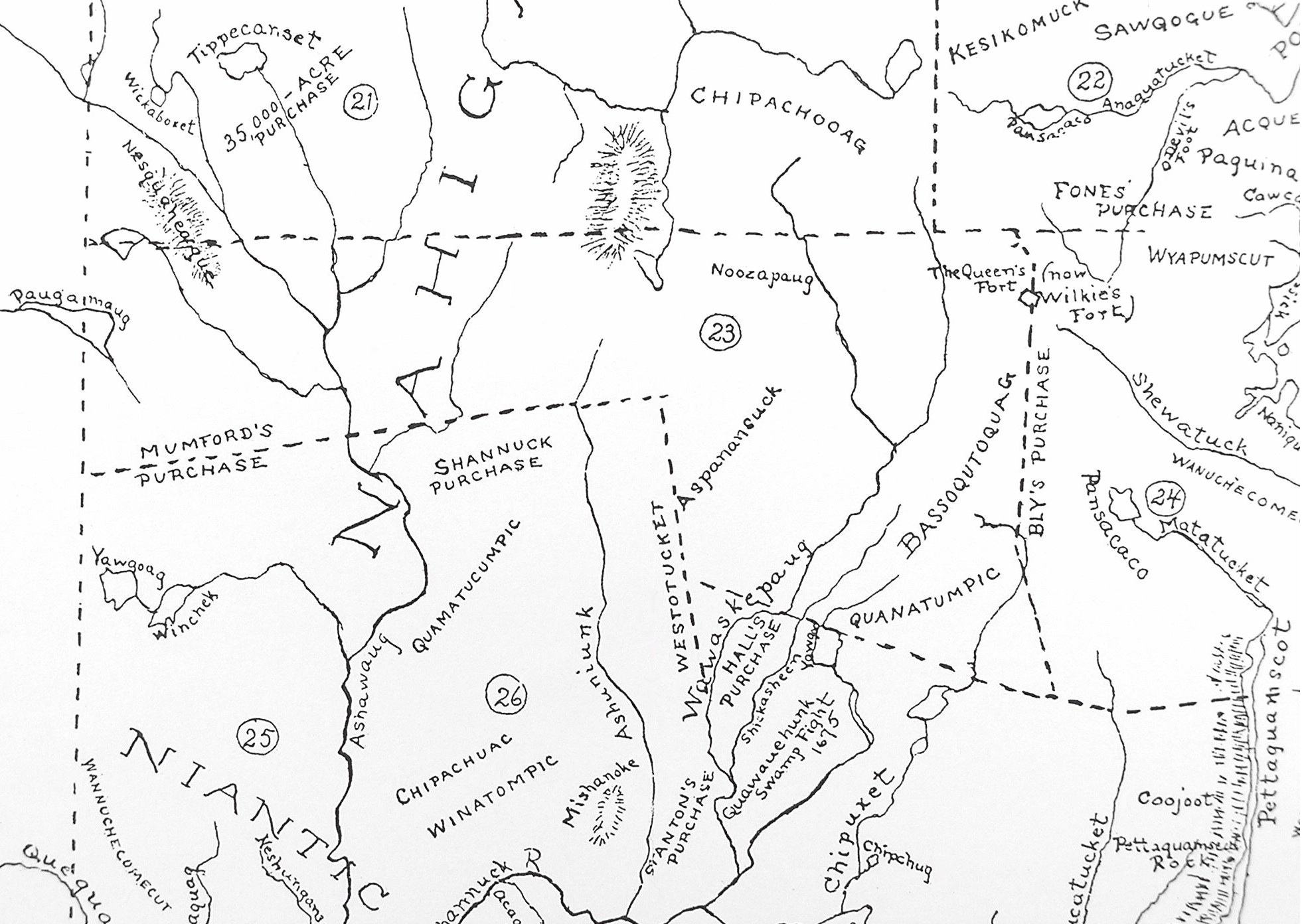
Towns indicated by circled numbers:
21 - West Greenwich 22 - East Greenwich 23 - Exeter 24 - North Kingstown 25 - Hopkinton 26 - Richmond
Exeter locations or landmarks identified on this map:
|
Indian name |
modern name |
Description |
| Paugamaug | Beach Pond | No explanation or meaning for the name of this large pond shared with Connecticut |
| Nesquaheage | Escoheag Hill | No explanation or meaning for this upland area extending into West Greenwich. |
| Noozapaug | Nooseneck Hill | This is a corruption of the terms Noosup-paug (beaver pond) and "neck" (a tract of land between two small streams). On this map it corresponds to the unlabeled hill to its left that straddles the boundary between Exeter and West Greenwich. |
| Aspanansuck | Casey Hill area | This was an Narragansett Indian village associated with Wawaloam, wife of Miantunnomu (Miantinomi), a Narraganset sachem. Exeter's Wawaloam Elementary School is located near this spot. |
| Westotucket | Glen Rock Brook | The name was applied to both the small brook and a 1662 land purchase. |
| Wawaskepaug | Usquepaug River | The Queen's River drains much of eastern Exeter and merges with Glen Rock brook to become the Usquepaug river in the Town of South Kingstown. |
| Shickasheen | Chickasheen Brook | Appears to be mislabeled on this map. The present day brook flows into Yawgoo Pond then into Barber's Pond (in South Kingstown). The brook on this map is now just a swampy area |
| Yawgoo | Yawgoo Pond | This small pond straddles the border between Exeter and South Kingstown |
| Quanatumpic | Yorker Hill | No explanation or meaning for the name of this hill is given |
| Bassoqutoquag | Ladd School / Veteran's Cemetery | Possibly an Indian village or locality on not precisely indentified with any current landmarks. |
| The Queens Fort | Stony Lane area | A large pile of glacial boulders located on the Exeter - North Kingstown border long associated with the Narragansett Indians, but probably not ever used as a fortress. |